From Nile to Sinai: A Comprehensive Guide to the Diverse Geographical Features in Egypt
Geographical features in Egypt play a major role in shaping the country’s history, climate, population distribution, and way of life. Egypt’s landscape is defined by dramatic contrasts, where fertile river valleys exist alongside vast deserts, rugged mountains, and long coastlines.
From the life-giving Nile River to the arid expanses of the Eastern and Western Deserts, Egypt’s geography has influenced settlement patterns, agriculture, trade routes, and political power since ancient times. These natural features continue to affect modern economic activities, tourism, and environmental challenges.
In this article, we will explore the main geographical features in Egypt, explain their characteristics, and understand why geography has always been central to Egypt’s development.
Where is Egypt geographically located?
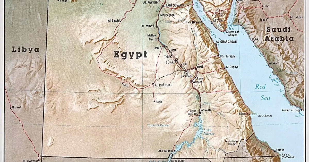
- Egypt is geographically located in the northeastern corner of Africa, with a small but significant portion of its territory extending into southwestern Asia. This unique position makes Egypt a transcontinental country and a natural bridge between Africa and Asia.
- To the north, Egypt is bordered by the Mediterranean Sea, which has historically connected it to Europe and facilitated trade and cultural exchange. To the east, Egypt borders the Red Sea, along with Israel and the Gaza Strip, while the Sinai Peninsula lies in Asia. Sudan forms Egypt’s southern border, and Libya lies to the west.
- Egypt’s strategic location is further emphasized by the Suez Canal, which links the Mediterranean Sea to the Red Sea and serves as one of the world’s most important maritime trade routes. This geographic position has given Egypt immense political, economic, and historical importance throughout ancient and modern times.
- Overall, Egypt’s location at the crossroads of continents and seas has shaped its role as a center of civilization, trade, and cultural interaction for thousands of years.
Read:
geographical features in egypt
Egypt’s geography is defined by a combination of rivers, deserts, mountains, and coastlines, each playing a vital role in shaping the country’s environment and human settlement.
The Nile River.
The Nile River is the most important geographical feature in Egypt. It flows from south to north and forms a fertile valley and delta where most of the population lives. The river supports agriculture, provides fresh water, and has been central to Egyptian civilization since ancient times.
The Nile Delta.
Located in northern Egypt, the Nile Delta is a broad, fertile area where the river spreads out before reaching the Mediterranean Sea. It is one of the most agriculturally productive regions in the country.
The Western Desert.
The Western Desert covers about two-thirds of Egypt’s land area. It includes vast sand seas, plateaus, and several oases such as Siwa, Bahariya, and Farafra. This desert is sparsely populated and characterized by extreme aridity.
The Eastern Desert.
The Eastern Desert lies between the Nile Valley and the Red Sea. It is more mountainous than the Western Desert and contains valuable mineral resources. Historically, it served as a route for trade and mining activities.
The Sinai Peninsula.
The Sinai Peninsula is located in Asia and separates the Mediterranean Sea from the Red Sea. It features rugged mountains, plateaus, and desert landscapes, including Mount Sinai, one of the highest peaks in Egypt.
Mountains of Egypt.
Egypt’s mountain ranges are mainly found in the Sinai Peninsula and the Eastern Desert. These mountains influence local climate patterns and contain important natural resources.
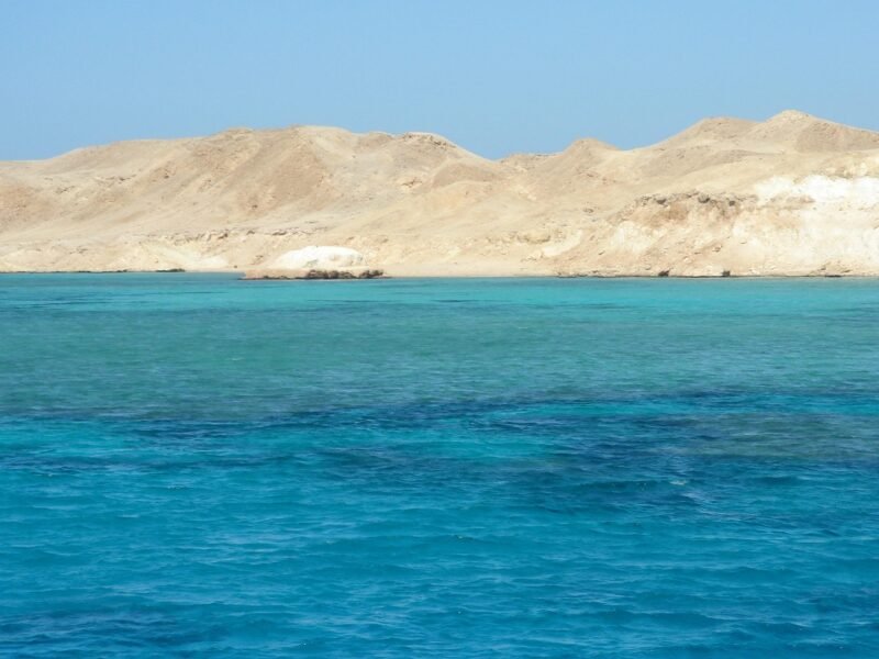
Seas and Coastlines.
Egypt has coastlines along both the Mediterranean Sea and the Red Sea. The Mediterranean coast is important for agriculture and trade, while the Red Sea coast is known for coral reefs, tourism, and maritime routes.
Together, these geographical features in Egypt explain the country’s climatic conditions, settlement patterns, economic activities, and historical importance.
Also read:
Which countries share borders with Egypt?
Egypt shares its land borders with four entities, reflecting its strategic position between Africa and Asia.
- Libya: Egypt’s western neighbor, sharing a long desert border that extends across North Africa.
- Sudan: Located to the south, Sudan shares a historically and culturally significant border with Egypt along the Nile Valley.
- Israel: Egypt’s northeastern neighbor, connected through the Sinai Peninsula and bordering Egypt at the Taba region.
- Gaza Strip (Palestine): Egypt shares a short border with the Gaza Strip at Rafah, playing an important role in regional geopolitics.
In addition to land borders, Egypt is bordered by the Mediterranean Sea to the north and the Red Sea to the east, further enhancing its geographical and strategic importance.
Related:
What is the historic devision of Egypt?
The historic division of Egypt refers to the traditional way the land was organized in ancient times, based largely on geography and the flow of the Nile River. This division played a central role in Egypt’s political structure, culture, and identity for thousands of years.
Upper Egypt.
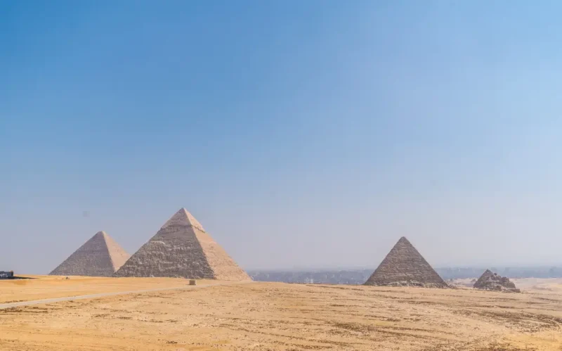
Upper Egypt is located in the southern part of the country, stretching from Aswan northward to the area around modern Cairo. Despite its name, it is called “Upper” Egypt because it lies upstream along the Nile River. This region is characterized by a narrow river valley bordered by desert cliffs and was the heartland of early Egyptian civilization.
Lower Egypt.
Lower Egypt lies in the northern part of the country, where the Nile River spreads out into the fertile Nile Delta before reaching the Mediterranean Sea. It is called “Lower” Egypt because it is downstream. This region was known for its rich agricultural land and dense population.
The Unification of Egypt.
Around 3100 BCE, Upper and Lower Egypt were unified under a single ruler, traditionally identified as King Narmer. This unification marked the beginning of dynastic Egypt and established a centralized state that lasted for millennia.
Additional Historical Regions.
- The Nile Delta: Often considered part of Lower Egypt, but historically significant enough to be treated as a distinct region in administration and economy.
- The Sinai Peninsula: Served as a strategic frontier and bridge to Asia rather than a core part of ancient Egyptian settlement.
- Desert Regions: The Eastern and Western Deserts acted as natural barriers that protected Egypt and contained valuable resources.
The historic division of Egypt into Upper and Lower Egypt remains one of the most important geographical and cultural concepts in understanding ancient Egyptian history and state formation.
What geographic feature was Egypt known for?
- Egypt was best known for the Nile River, the most important geographic feature in the country’s history. The Nile provided a reliable source of fresh water, fertile soil, and transportation, making it the foundation of ancient Egyptian civilization.
- Each year, the Nile flooded its banks, depositing rich silt onto the surrounding land.
- This natural process allowed Egyptians to practice agriculture in an otherwise arid environment and earned Egypt the ancient description as the “Gift of the Nile.” Nearly all major cities, temples, and settlements developed along its banks.
- Beyond agriculture, the Nile served as a natural highway, enabling trade, communication, and political unity between Upper and Lower Egypt. Its predictable flow shaped religious beliefs, seasonal calendars, and economic stability.
- While Egypt is also known for its deserts, seas, and strategic location, it was the Nile River that defined Egypt’s identity and made long-term civilization possible. This single geographic feature remains the primary reason Egypt emerged as one of the world’s earliest and most enduring civilizations.
Suggested:
FAQ
What are the main geographical features in Egypt?
The main geographical features in Egypt include the Nile River, the Nile Delta, the Western Desert, the Eastern Desert, the Sinai Peninsula, mountain ranges, and coastlines along the Mediterranean and Red Seas.
Why is the Nile River important to Egypt?
The Nile River is important because it provides fresh water, fertile land for agriculture, and a natural transportation route. It made permanent settlement and ancient civilization possible in Egypt.
What deserts are found in Egypt?
Egypt contains two major deserts: the Western Desert, which covers most of the country, and the Eastern Desert, located between the Nile Valley and the Red Sea.
Where is the Sinai Peninsula located?
The Sinai Peninsula is located in northeastern Egypt and lies in Asia. It separates the Mediterranean Sea from the Red Sea and serves as a land bridge between Africa and Asia.
Which seas border Egypt?
Egypt is bordered by the Mediterranean Sea to the north and the Red Sea to the east.
How did geography protect ancient Egypt?
Deserts, seas, and mountains acted as natural barriers that protected Egypt from invasion, while the Nile connected regions within the country.
What geographic feature was Egypt best known for?
Egypt was best known for the Nile River, which shaped its agriculture, economy, religion, and political unity for thousands of years.
Conclusion
Egypt’s geography has played a decisive role in shaping its history, civilization, and modern development. From the life-giving Nile River to vast deserts, rugged mountains, and strategic coastlines, each geographic feature has influenced how people settled, farmed, traded, and defended the land.
Understanding the geographical features in Egypt helps explain why ancient Egyptian civilization emerged where it did and why Egypt continues to hold strategic importance today. Natural barriers provided protection, fertile lands supported agriculture, and waterways enabled communication and unity.
Together, Egypt’s rivers, deserts, seas, and regions form a unique geographical landscape that connects Africa and Asia while linking the ancient past with the modern present. Geography remains one of the strongest forces shaping Egypt’s identity, resilience, and lasting significance.
Leave a Reply