Exploring the Major Landforms of Egypt: From the Nile Delta to the Great Sand Sea
Egypt’s geography tells a clear story shaped by deserts, rivers, and coastlines. Understanding the major landforms of egypt helps explain how people settled, how trade developed, and why certain regions remain more populated than others.
From vast arid areas to fertile riverbanks, these landforms influence climate, agriculture, and daily life. Looking at them together gives a simple, practical picture of how nature and human activity connect across the country.
Table of Contents:
Togglemajor landforms of egypt
The major landforms of Egypt are the large natural features that shape the country’s physical geography and influence where people live and work. These landforms are mainly deserts, a river valley, and coastal areas.
The main major landforms of Egypt include:
-
The Nile Valley and Nile Delta, which are fertile areas formed by the Nile River and support most of the population
-
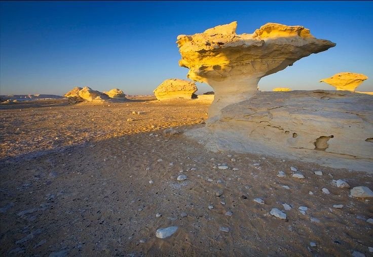
The Western Desert, a vast arid region with sand dunes, plateaus, and depressions
-
The Eastern Desert, a rocky area between the Nile Valley and the Red Sea with mountains and mineral resources
-
The Sinai Peninsula, a triangular landmass with mountains in the south and plateaus in the north
-
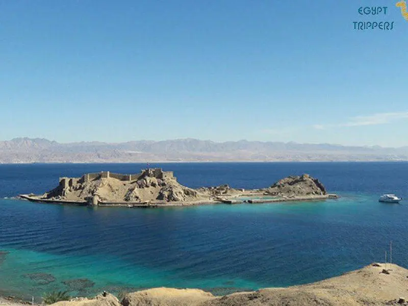
Coastal plains along the Mediterranean Sea and the Red Sea
Together, these landforms explain Egypt’s climate, settlement patterns, and economic activities.
Read:
What are some important landforms in Egypt?
Egypt has several important landforms that shape its geography and daily life. These landforms affect climate, settlement, agriculture, and transportation across the country.
Some of the most important landforms in Egypt are:
- The Nile River Valley, a long fertile strip where most Egyptians live
- The Nile Delta, a broad, flat area of rich soil near the Mediterranean Sea
- The Western Desert, known for sand dunes, oases, and wide plateaus
- The Eastern Desert, made up of rugged mountains and rocky terrain
- The Sinai Peninsula, which includes high mountains in the south and flat plateaus in the north
- Coastal plains along the Mediterranean Sea and the Red Sea
Together, these landforms explain why population and development are concentrated in certain parts of Egypt while other areas remain sparsely inhabited.
Also read:
What is the geography of Egypt like?
- The geography of Egypt is defined by a strong contrast between fertile land and vast desert areas. Most of the country is arid, with dry climate conditions and very little rainfall throughout the year.
- At the center of Egypt’s geography is the Nile River, which flows from south to north and creates the Nile Valley and Nile Delta. These areas contain fertile soil and support most of the population, agriculture, and cities.
- On both sides of the Nile lie large deserts. The Western Desert covers much of Egypt and includes sand dunes, plateaus, and scattered oases. The Eastern Desert is more mountainous and stretches between the Nile and the Red Sea.
- Egypt also has important coastal areas along the Mediterranean Sea to the north and the Red Sea to the east. In the northeast, the Sinai Peninsula forms a land bridge between Africa and Asia, with rugged mountains in the south and flatter land in the north.
Related:
What natural resources does Egypt have?
Egypt has a variety of natural resources that support its economy and development. These resources come from its land, seas, and underground reserves.
Some of Egypt’s main natural resources include:
-
Petroleum and natural gas, found mainly in the Gulf of Suez, the Western Desert, and offshore areas
-
Minerals such as gold, phosphates, limestone, gypsum, and iron ore
-
Fertile soil along the Nile Valley and Nile Delta, which supports agriculture
-
Salt, especially from coastal areas and salt lakes
-
Stone resources like granite and marble, used in construction and industry
In addition to these, Egypt benefits from renewable natural features such as abundant sunlight and wind, which are used for energy production in some regions.
How Egypt’s Landforms Shaped Its Ancient Civilization?
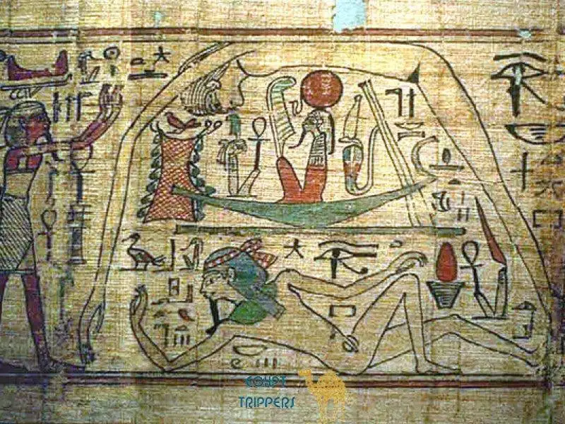
Egypt’s landforms played a direct role in how its ancient civilization developed. The natural environment shaped where people lived, how they farmed, and how the state stayed stable for long periods.
The Nile River was the core influence. Its regular flooding left fertile soil along the Nile Valley and Delta, making farming possible in an otherwise dry region and supporting steady food production.
Surrounding deserts offered natural protection. The Eastern and Western Deserts limited invasions, which helped ancient Egypt remain relatively secure compared to neighboring regions.
Other landforms also supported growth:
-
The Nile served as a transportation route, connecting Upper and Lower Egypt
-
Deserts contained minerals and stone used for tools, temples, and monuments
-
Seas nearby allowed trade with other civilizations
Together, these landforms created a balanced environment that supported agriculture, trade, political unity, and long-term cultural continuity.
Suggested:
What is the climate in Egypt like?
The climate in Egypt is mostly hot and dry, with long summers and mild winters. Rainfall is very limited, and most areas receive little to no rain during the year.
Summers are generally very hot, especially in desert regions, while winters are cooler but still relatively mild. Temperatures can vary between daytime and nighttime, particularly in the deserts.
Key features of Egypt’s climate include:
-
Hot, dry desert climate across most of the country
-
Very low rainfall, except for small amounts along the Mediterranean coast
-
Cooler winters, especially at night
-
Coastal areas that are slightly milder due to sea influence
Overall, Egypt’s climate has encouraged reliance on the Nile River for water and agriculture, shaping settlement patterns throughout history.
What is the best way to see Egypt’s landscapes?
The best way to see Egypt’s landscapes is by combining different types of travel, since the country’s geography is very diverse. Each region offers a different experience shaped by deserts, rivers, and coastlines.
Many travelers start along the Nile River. Moving between cities like Luxor and Aswan allows you to see fertile riverbanks, farmland, and desert edges in one journey.
Other effective ways include:
-
Desert trips to the Western or Eastern Desert to experience dunes, oases, and rocky terrain
-
Coastal travel along the Red Sea or Mediterranean to see beaches, mountains, and marine environments
-
Road travel across the Sinai Peninsula to observe mountains, plateaus, and wide open landscapes
Together, these approaches give a clear and balanced view of Egypt’s natural landscapes and how they vary from one region to another.
Discover Our Exclusive Egypt Tours with egytrippers
egytrippers offers carefully designed Egypt tours that help you experience the country in a clear, comfortable way. Each trip focuses on authentic places, local insight, and smooth travel planning from start to finish.
Whether you want to explore ancient sites, relax by the Red Sea, or travel along the Nile, these tours are built to match different interests and travel styles. The goal is simple: help you see Egypt without stress, rushing, or confusion.
With local knowledge and flexible itineraries, egytrippers makes it easier to enjoy Egypt’s history, landscapes, and culture in one well-organized journey.
Contact Us at Egytrippers
Getting in touch with Egytrippers is simple and direct. Whether you have questions about tours, need help planning your trip, or want more details about services, the team is ready to assist.
You can reach out for personalized support, itinerary details, or general inquiries. The focus is on clear communication and quick responses to help you plan your Egypt experience with confidence.
Also related:
FAQ
What types of tours does Egytrippers offer?
Egytrippers offers a range of guided tours that include historical sites, Nile cruises, desert experiences, and Red Sea destinations, depending on traveler interests.
Can tours be customized?
Tours can often be adjusted to fit travel dates, group size, and preferred activities, allowing for a more personal travel experience.
Are the tours suitable for first-time visitors to Egypt?
Yes, the tours are designed to be clear and well-organized, which makes them suitable for travelers visiting Egypt for the first time.
How can I book or ask about a tour?
You can contact Egytrippers directly to ask questions, request more details, or begin the booking process.
Conclusion
Egypt’s geography and history come together in a way that is easy to understand when you look at its land, climate, and natural features as a whole. From the Nile to the deserts and coastlines, the major landforms of egypt explain why life developed where it did and how the country continues to function today.
If you want to experience these landscapes firsthand, consider planning a trip that lets you explore them in a simple, well-organized way.
Hamdy
An Egyptian travel writer and researcher dedicated to helping visitors craft smart, well-planned itineraries. Hamdy doesn't just provide geographical facts; he shares personal insights on transportation, hospitality, and ancient sites to ensure every traveler’s visit to Egypt is both safe and unforgettable.

Leave a Reply